• Get Paid to Write for Comando Supremo: We are looking for talented researchers/writers who are fluent in English and can write original content on Italy in World War Two. Please reach out to webmaster@comandosupremo.com if interested!

Discussion on Operazione «C3» / Herkules

jwsleser

Administrator
Staff member
I am openning a thread to discuss the plan for this operation. This discussion started in a different forum and I will cut and paste any appropriate material. Individuals who had participated in that early discussion can also cut and paste whatever is need. Please identify the source if you do so.

For the current denizens of Comando Supremo, please add anything that you can.

Pista! Jeff
 
Last edited:

jwsleser

Administrator
Staff member
Part of the discussion was the landing sites in zona Famagosta. Gabriele gave the descriptions of the possible landing points, but not a map showing their precision location. Using the descriptions, a period map, and some assumptions, these are my best guesses as to the points descripbed. Any correction are welcome. Translation nd info in brackets are mine.

From Gabriele p. 166.

The plan contained the detailed description of the landing points in the Islands of Malta and Gozo. Those of the Famagosta area were particularly illustrated and had been chosen in relation to the possibilities offered by the conformation of the land to the outflow of troops and vehicles towards the hills above.

- Point A, located above a rock drop, almost steep, 8 meters above sea level after about 50 m of varied terrain, a trafficable track was reached, which, 450 further on, led to an ordinary road.

- Point C, at sea level; after a short stretch (50m) of an ordinary road with a steep slope (30%) and another 50m on the flat, you will reach a path with an average gradient of 21%, but with a 40m stretch with an 80% gradient; this path, after about 475 m, came out as usual.

- From points B and D it was possible to access the same path as point G, after a short path on varied terrain; point B was at 6 m and point D at 2 m above sea level. From point C it was also possible to reach the ordinary road on which the trafficable track starting from point A joined.

- Point F was about 10 m above the sea; the ground behind it was somewhat harsh, partly on a path and partly on varied terrain for a total of 500 m (maximum slope of 50%); This led to a country road, which after about 1 km led to a cart track, which in turn led to an ordinary road.

- Point G was 2 m above sea level; from it a path of about 500 m on varied terrain that is fairly easy (only the first stretch of 120 in had a gradient of 30%) led to a country road that ended, 600 more further, on an ordinary road .

- Point I, at sea level, was at the foot of a flight of steps of about 80 m, with steps high at 0.20 m and wide at 0.80 m, which led to the village of Zurriek, from which an ordinary road began with gradient of 14% in the first stretch of 530 m and then flat.

- From point L, about 8 m above sea level, it was also possible to reach the village of Zurriek, along a short stretch of varied flat terrain.

- From point M, at about 2 m above sea level, after a 300 m stretch of varied, fairly easy terrain, you reached a mule track, which after about 360 in joined the ordinary road.

The S.M. of the Army [Superesercito], with regard to the landing points in the Famagosta area, left to the commands of G. U. [Grandi unità/major units/here divisions and corps] the task of dividing the forces to land on each point into tactical groups. Since the particular plans by the commands of G.U. are not compiled, it is not possible to know in detail the number of men and vehicles that should have landed at the individual landing points.

My map of the possible locations. M is outside the zona Famagosta landing area, but I couldn't find a better place for it. There might be some breaks in the buffs that are too small for the map scale.

Pista! Jeff


Zona Famgosta copy.jpg
 
Last edited:

Brucew

New Member
First, a big Thank You to Jeff for sponsoring this thread. The impetus for the subject was my appeal for research assistance for a Malta invasion game on which I've begun working. The actual event was to occur in June (or July? or August?) 1942, but although much effort and resources were devoted to it, the invasion never came to fruition. Since I’m sure that everyone appreciates the strategic significance of the island to both sides, I don’t think we need to spend much time debating why an invasion was given serious consideration by the Axis; rather, we’d like to know how it was supposed to happen, how the defenders were preparing for it and, perhaps, how it might actually have played out?

But that might be something for the game to resolve ;-)

Given that most of the information available in English (in books, articles, and on-line) is from very few, often repetitious, frequently unreliable sources, there is much to learn here – concerning the forces and intentions of both sides.

Jeff touched on this lack of reliable information when he outlined the amphibious landing sites identified by the Italian planners of Operation “C3”. From excerpts of The Plan published on-line long ago by Davide Pastore, I learned that most of the infantry divisions involved in the operation were to come ashore in a portion of the southern coast code-named “Famagusta”. This sector stretched from a promontory southwest of Qrendi Airfield east to an inlet just south of Qrendi village (see map). This amounted to about 4.5 kilometers of some of the most forbidding terrain one could imagine for an amphibious assault – especially one with upwards of 28,500 – 38,000 troops (depending on whether three for four divisions went ashore). And then there was all their equipment (48 prime movers and light trucks, 24 pieces of light field artillery, scores of mortars, motorcycles, and machine guns …plus 1000 tons of “assorted supplies” per division. And 46 AFVs in the first three divisions, too).

Although there’s little indication on Google Earth imagery or the plentiful hand-held photos that the steep cliffs in Famagusta zone could possibly be surmounted by all that, the C3 plan is quite specific: several negotiable sites and paths exist, even if they’re not too evident in modern imagery. The descriptions are specific and detailed enough (see the excerpt from Gabriele’s book in Jeff’s first entry) that we have to admit that the General Staff planners apparently knew what they were talking about. To secure the precipitous landing areas, several battalions of paratroops would land first, sealing off the coastal area until the amphibious forces were ashore and organized. Then, they’d all attack towards their preliminary objectives: at least one airfield and the excellent harbor at Marsaxlokk Bay

Okay – so it’s possible to put several divisions ashore where the British evidently thought no one would dare to pass (where have we heard that before?). Reinforcements coming into the captured airfields and Marsaxlokk would quickly overwhelm the defenders, just as had happened the previous year on Crete. Mission accomplished!

There’s a number of questions I have before considering those details, however, and I hope someone might have the answers.

The Italian planners optimistically included the whole of the German 7.Flieger Division in their plan, although most of it was still in Russia, or being reconstituted back in the Reich. Possibly only four battalions (plus support troops), constituted as the “Ramcke Brigade” could have participated. Unless there were other German airborne formations sufficiently filled out, equipped and trained to have participated as well?

The C3 plan assumes that the (slimmed-down) Italian assault divisions were at a full strength of 9500 men each, although most Italian formations at this time were at only a fraction of their authorized TO&E. Of course, most of those other units were having a hard time in Africa at this time, too. Perhaps the Malta invasion force was carefully kept topped up in the expectation that they’d need every man?

More questions, considerations, and discussion to follow! Thanks to anyone who can contribute to this thread …your input will be most appreciated!

Bruce
 

Perun

New Member
Hi again mates, i found nice oob for Fliegerkorps II at http://www.niehorster.org/011_germany/42-oob/42-06-28_blau/Luftwaffe/flk_02.html

And useful data on german bombing of Malta at

One question for all, should I post only link to interesting source or should I quote interesting paragraphs and post link to source
 

jwsleser

Administrator
Staff member
One question for all, should I post only link to interesting source or should I quote interesting paragraphs and post link to source

The rule I go by is, if possible, post the important/critical information on CS and provide the link to the source. The issue is that all too often the original site disappears and all one has in the discussion is a broken link. There is nothing more frustrating that to find that critical bit of information you have been searching for when reading a thread only to click the link to that data and get someone try to sell that IP address.

If it is important to the discussion, copy/rewrite it and link the source.

Pista! Jeff
 

jwsleser

Administrator
Staff member
Bruce

The Italian planners optimistically included the whole of the German 7.Flieger Division in their plan, although most of it was still in Russia, or being reconstituted back in the Reich. Possibly only four battalions (plus support troops), constituted as the “Ramcke Brigade” could have participated. Unless there were other German airborne formations sufficiently filled out, equipped and trained to have participated as well?

I can't help with that question. I haven't read anything that indicates the 7.Flieger Division was understrength, but I don't study the Heer in detail.

The C3 plan assumes that the (slimmed-down) Italian assault divisions were at a full strength of 9500 men each, although most Italian formations at this time were at only a fraction of their authorized TO&E. Of course, most of those other units were having a hard time in Africa at this time, too. Perhaps the Malta invasion force was carefully kept topped up in the expectation that they’d need every man?

Yes, the Italian formations were all at 100%. They underwent some pretty intensive training. After «C3» was cancelled, several of the units involved were transferred to A.S. (Africa settentrionale/North Africa).

Pista! Jeff
 

jwsleser

Administrator
Staff member
I have been reading through Superesercito plan for the invasion. I will lay out the forces on the ground by the end of day so we know what is planned and needs support.

X - the two parachute divisions.

X+1 «Friuli», «Livorno», and the «raggruppamento corrazzato».

Everything after X+1 is based the progress of the operation. I am assuming the earliest arrival.

X+2 «Napoli» and the artillery of the C.A. lands in Marsa Scirocco (already captured), «Assietta» lands in the zona Famagosta.

«Superga» will land part of its units on Gozo at some point. On order, it will land a regimental sized raggruppamento in th north.

»La Spezia» is in reserve.

In terms of logistics, the two parachute divisions are resupplied the night on X, the two infantry divisions and the Reco start being resupplied on X+2.

There isn't this rush to start landing vast amounts of supplies until after X+3 and Marsa Scirocco is already in Italian hands.

Pista! Jeff
 

Brucew

New Member
I was fortunate to find this excellent ordnance survey topo on the Yale University site (https://collections.library.yale.edu/catalong/15502086) in the slightly unconventional scale of 1:31,680 -- so each grid square is 1000 yards. (Apologies for posting it in two pieces; I'd already reduced the complete map as far as I could without it becoming completely illegible, but the file size was still too big to post) The aerial survey upon which it is based was completed in 1927, the map was drawn in 1934 by the General Staff Geological Survey section (subsequently revised and preprinted in February 1943, and later by the US Army Map Service). As such, provides an excellent impression of the geographical and cultural features of the island as they would have appeared at the time of "C3/Herkules". Interestingly, one of the Italian General Staff's operational maps of C3 was also based on this map.

While many military features are faithfully represented -- forts and barracks, for instance -- details of the airfields and dockyards have been discreetly excised. Not surprisingly, some coastal defense battery positions may have left out too, although without knowing where they were actually located in 1943, I'm unable to say how pervasive this was. The presence of the late 19th century northern defense barrier -- the so-called "Victoria Lines" is acknowledged on the map, but no trace is provided... even though this continuous line of fortifications was very well known, and abandoned as obsolete almost as soon as it was finished in 1900.

1  Malta 1943 topo small LEFT.jpg
1  Malta 1943 topo small RIGHT.jpg


So here's another opportunity to confirm some history: does anyone have the locations of the Royal Artillery defenses (coastal and other) as they existed in 1942? The Italians supposedly had them all located -- through thorough and continuous aerial recce flights -- but only a vague idea of what guns were in most locations). I have a listing posted years ago on the NAV WEAPS discussion boards, but the link no longer works ...and I have no idea how accurate that list is. Any help here would be most appreciated. Thank you!

Bruce
 
Interesting topic! It's a bit beyond my scope to add anything new or interesting.
I built a scenario of my own once using the map editor from Talonsoft's eastfront westfront series using scant information.

The last article I read about the topic was Andy Hill's article on tank encyclopedia.


I noticed from the the article the Japanese provided their expertise in amphibious landings and at one point there was talk of landing captured Russian heavies (KV-2).
 

Dili

Member
EN Plan

Naval Bombing: by Doria and Dulio of Eastern : Ghajn Tuffieha(SW), Mellieha Bay(NW), Bhar-ic-Caghaq(?), It is also said the should bombard Benghisa fort before the glider assault.
Paras drops Dingli(NW)and Bubaqra(SE) in 3 drops(each 8000 parachutists)at 13.30,16:15,19:00 plus a secondary operation at Benghisa Fort with 30 DFS-230 gliders to destroy 2x234mm guns at 20:00 . X+1 01:00 1200 men CCNN da Sbarco naval land after this atack to help the parachutists.
200 dummy paras dropped in central Malta.
In total 13000 German paras and 11000 Italian Folgore divsion+850 Loreto bn to prepare landing zones and put existing landing grounds ready( incomplete landing ground at Qrendi and Hal Afar)
The paras major mission was to control the axis: Dingli-Bubaqra to protect naval landing zones that will occur the night after their drop.
Malta X+1 01:00 : southern Malta - called Famagosta between Ghar Lapsi, Wied-iz-Zurrieq main naval landing the night after the daily para drops.
First landing by 2000 men of Gruppo Bn CCNN da Sbarco(-) and San Marco Rgt of RM. With 60 motorcycles. After that 1100 German pioneers also with 60 motorcycles.
Then:
D. Friuli ---> direction sud east : Zurrieq, Hal Afar, Benghisa(8km)
X Raggruppamento Motocorazzato= 230 mototcycles and 8 Semovente da 75. ---> split to support both advances
D. Livorno ----> Zetjun (9km)
Gozo X+1 01:00
1000 men Gruppo Bn CCNN da Sbarco(-) and San Marco Rgt of RM.
D.Superga ---> takes all Gozo

Major glider operations only after take over of Hal Far airbase. Malta islands had too many stone walls.
Landing ships should return as fast as possible to Sicilian ports to get the remaining units of Friuli and Livorno and also thye first units of Assieta and Napoli divisions.

Source: Storia Militare Le Tre Previste Invasioni di Malta parte 2º Joseph Caruana.
 

Brucew

New Member
Still curious about the participation of the German 7.Flieger Division (which had been assigned a large role in “Herkules” by the Italians), I found this operational synopsis on the Lexikon der Wehrmacht site (http://www.lexikon-der-wehrmacht.de/Gliederungen/Fallschirmjagerdivisionen/Gliederung.htm):

The division was deployed to the Eastern Front in 1941, where it suffered heavy losses. Most of the division was returned to Germany for rebuilding in December 1941, but one regiment – FJR 2 – remained in Russia until July 1942. During the spring of 1942, when the Italians were undergoing intensive training for the invasion of Malta, most of the 7th FD was still absorbing new recruits and rebuilding itself (from April 1942) in France– including the creation of an expanded artillery component and a new 4th Parachute Infantry (FJ) regiment to replace the now permanently-detached FJR 2. This continued through September – well past our Malta invasion window – until the division returned to Germany. It was back in combat in Russia the next month.

There are some spare bits of this story – that Davide Pastore picked up on years ago – which can be expanded. We know that GM Ramcke was in Italy coordinating with the Folgore division during the spring of 1942 – so there must have been the expectation of some German airborne participation in Herkules/C3 that year. Was this limited to just the “Ramcke Brigade”? The Lexikon site maintains that Ramcke’s boss (General Student) was directed to form a parachute brigade to reinforce the greatly-depleted Afrika Korps in July 1942; this actually occurred in mid-July. I suspect that the establishment of this ad hoc “brigade” was just a formality, however, and that it was already functioning as such before July in anticipation of participating in the Malta invasion. It consisted of four battalions:

One, under Major Kroh, was largely the survivors of the first battalion of FJR 2, just returned from Russia (no rest for them!)

The paratrooper training unit (I.FJR 3) in Berlin furnished a battalion combat group, under the famous Major Von der Heydte

Major Hübner brought the 2nd battalion of the independent 5.FJR

Major Burkhardt’s paratroop training battalion (FJ-Lehr-Battalion) had just completed a short tour of duty with the Afrika Korps in April 1942, and an even shorter rest period in Germany when it was incorporated into Ramcke’s brigade.

Also included was an airborne artillery battalion from FJ Artillery Regt 7, a Pionier Company, and a Panzerjäger company with 12 obsolete 37mm PaK 35/36s. Not sure what the artillery battalion used; could have been either the 75mm or 105mm recoilless guns that were already in service with German airborne forces or – since larger cargo gliders were now available – they might have been equipped with the Heer’s standard field artillery pieces.

And that, it would seem, is the “second parachute division” that the C3 plan called for. I don’t have any information about unit strengths.

Can anyone provide a bit more detail than this?
 

jwsleser

Administrator
Staff member
The Italian OB is well known and if no one else posts it, I will do it at some point. The challenge (at least from what I have observed) is pinning down the UK and German.

I have found two university theses that state that two FJ regiments had moved to Viterbo in the spring 1942. I personally am not comfortable with the sources cited, but that is me.

https://scholarworks.umt.edu/cgi/viewcontent.cgi?article=3928&context=etd for two regiments p. 57

https://apps.dtic.mil/dtic/tr/fulltext/u2/a401127.pdf For increased training p. 33, for the two regiments p. 34
 

Perun

New Member
I found these for Malta artillery:

At the time the Royal Malta Artillery was deployed as follows:

1st Coast Regiment RMA – St Rocco, Tigné, Ricasoli and St Elmo – RHQ St Elmo.

11th HAA Regiment RMA(T) – St Peter, Sta Maria, Nicola, Delimara, Giacomo and Hompesch – RHQ Żejtun.

2nd HAA Regiment RMA – Kala Hill, Albert, Tarġa, Nadur, Wardija and Salina – RHQ St Paul’s Bay.

3rd LAA Regiment RMA - Marsaxlokk, St Rocco and Grand Harbour East areas – RHQ Żejtun.

5th Coast Regiment RMA – Campbell, Delimara – RHQ Campbell.

8th Searchlight Battery RMA – 3,000 yard spacing between stations – BHQ St Paul’s Bay.

5th HAA Battery RMA – Egypt. In October 1942, its eight HAA guns took part in the artillery bombardment – ground role – prior to the El Alamein advance.

In 1942, there were over 10,500 gunners defending Malta, nearly half of whom were Maltese serving in the RMA. In May 1942, the AA gunners were acclaimed as having saved Malta as for two months they had provided the only defence against the Luftwaffe’s determined and fierce blitz to erase Malta off the map.


jwsleser

Administrator
Staff member
Does anyone have this book on the 7ª Flieger/1ª FJ Division? It might have the answers. It is not my area of research, so I won't spent any coin to purchase it.


Perun

New Member
This I found for British and Malta ground units:

The Reinforced Army Garrison[edit]​

On 11 March 1942 Malta Command became subordinate to General Headquarters (GHQ) Middle East.[12]

Infantry[edit]​

In late 1939 the pre-war garrison was reinforced up to an infantry division (commanded by Major General Sir Sanford John Palairet Scobell).[13] The original infantry garrison, plus the three brigades that reinforced the island's regular British Army were titled 1, 2, 3, and 4 Brigades; but were subsequently renumbered in 1943 as follows:[14]

Light Support Weapons[edit]​

NameTypePhotoNumbers on Island & Remarks
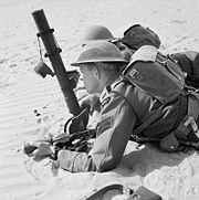
Two-inch mortarLight infantry mortar Rhodesian troops of the 60th King's Royal Rifles training with a 2-inch mortar in North Africa, 12 May 1942. E11699.jpg Each infantry battalion had 3 tubes per fighting platoon - circa 30
. 55-inch Boys anti-tank riflePlatoon anti-tank weapon ARMY TRAINING 001 013-0.55 inch Boys Anti-tank rifle.jpg Each infantry battalion had one per fighting platoon - circa 10. It was not a popular weapon to fire because of its extreme recoil and German tank armour was too difficult to penetrate, it was phased out in favour of weapons like the PIAT
.303 Lewis Light Machine Gun (LMG)Platoon fire support weapon Singapore Volunteer Force training November 1941.jpg Some infantry battalion (e.g. KOMR) had Lewis Guns in lieu of Bren LMGs. This was a WW1 design weapon but highly regarded because of the gun's magazine capacity and rate of fire
.303 Bren LMGPlatoon fire support weapon Bren1.jpg Each infantry battalion had three per fighting platoon and on other fire support vehicles - circa 40
Personal weapons such as the .303-in SMLE, 9mm Sten or .38 service revolver are not included in this study.

Artillery[edit]​

  • The Island's regular Royal Artillery force component was like its Maltese counterpart performing a mainly fixed defence role, even wheeled artillery tended to occupy fixed positions to defend against a hostile landing at beaches:
    • 4th Coast Regiment, RA made up of (a HQ Battery, 6th, 10th & 23rd Coast Batteries)
    • 12th Field Regiment RA - initially equipped with 18 Pounder Field Guns, but later equipped with 25 Pounder Field Guns (the only real mobile artillery support for the infantry brigades).[17]
    • 26th Defence Regiment, RA made up of (a HQ Battery, 15th/40th & 48th/71st Defence Batteries).
  • The Royal Malta Artillery
    • Headquarters, RMA
    • 1st Coast Regiment, RMA composed of (a HQ Battery, 1st, 2nd, 3rd & 4th Heavy Batteries)
The anti-aircraft defence was understandably dense and British and Maltese anti-aircraft (AA) units were interwoven into the following ORBAT:[18]

  • 7th Anti-Aircraft Brigade
    • 32nd Light Anti-Aircraft Regiment RA
    • 65th Light Anti-Aircraft Regiment RA
    • 74th Light Anti-Aircraft Regiment RA
    • 3rd Light Anti-Aircraft Regiment RMA
    • 4th Searchlight Regiment RA/RMA

Heavy Support Weapons[edit]​

By 1940 Malta Command had a small amount of modern mobile field artillery, much of its artillery was located in fixed positions in the anti-aircraft and coastal defence royal. It was manned by members of the Royal Artillery and Royal Malta Artillery.

NameTypePhotoNumbers on Island and Remarks
.303 Vickers Heavy Machine GunBattalion fire support weapon PrincessPatriciasCanadianLightInfantryTrainingMaximGunDec1942.jpg Each infantry battalion had four guns normally in a single Machine Gun Platoon
3 Inch MortarInfantry mortar - battalion indirect fire support British 3 inch mortar crew on exercises.jpg Each infantry battalion had 6 mortar tubes[19]
2 Pounder GunInfantry anti-tank weapon 2-pounder gun.jpg Each infantry battalion had two carried portee or dismounted in a 15cwt truck
18 Pounder Field gun/HowitzerMulti-role mobile field artillery 18pdrTowedByMorrisTractor1938.jpg One RA coastal defence regiment of 24 guns
25 Pounder Field gun/HowitzerMulti-role mobile field artillery 25 pounder field gun of 153rd Field Regiment 07-06-1943.jpg One RA field regiment of 24 guns
For details of fixed artillery see Royal Malta Artillery's equipment list.

Royal Armoured Corps[edit]​

Armour on Island[edit]​

By 1942 Malta Command Tanks had a small mixed force of Royal Tank Regiment tanks known as "Malta Tanks" during its time on the Island. The only other armoured vehicles were the Universal Carriers of the infantry units.[20]

NameTypePhotoArmament & Numbers on Island
Vickers Light Tank (Marks VIb&c)Reconnaissance Tank The British Army on Malta 1942 GM837.jpg Dual turret fit of a Vickers .5in and .303 or Dual turret fit of a Besa 15mm and 7.92 mm Machine Guns - Three Deployed
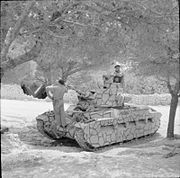
Matilda (Mark II)Infantry Support Tank The British Army on Malta 1942 GM836.jpg 2 Pounder 40mm gun & Besa 7.92 mm coaxial machine gun - Four Deployed
Cruiser (Mark III or A13)Cruiser Tank The British Army on Malta 1942 GM467.jpg 2 Pounder 40mm gun & Besa 7.92 mm coaxial machine gun - Eight Deployed
Valentine (Mark III)Infantry Support Tank Valentine tank CFB Borden 1.jpg 2 Pounder 40mm gun & Besa 7.92 mm coaxial machine gun - Four Deployed
Bren Gun CarrierLightly armoured tracked Infantry Weapons Carrier The British Army on Malta 1942 GM834.jpg .55 Boys anti-tank rifle and/or .303 Bren Light Machine Gun - 10 deployed with each infantry battalion[21]

Combat & Service Support Units[22][edit]​

  • Royal Engineers
    • 16th Fortress Company
    • 24th Fortress Company
    • 173rd Tunnel Company
    • 2 Works Company
    • 127th Bomb Disposal Section
    • 128th Bomb Disposal Section
  • Malta Command Signals, Royal Signals
    • 8 Special Wireless Squadron

Local Maltese Units (Regular and Territorial)[edit]​

Critical to the success and resilience of Malta's was local commitment and bravery the following units were fully integrated in Malta Command:[24]


Brucew

New Member
More OB stuff: last week on the TO&E Group someone contributed these two maps from a 2006 computer game "Conquest of the Aegean" by Panther/Matrix Games. The game included a Malta invasion module, with some very specific OB and and operational information. While not suggesting that these be taken as gospel, the British unit information, at least, seems to be correct. But can anyone comment on the accuracy of the British deployments shown -- or the brigade boundaries? From my limited appreciation of the British/Maltese defensive deployments, they seem to be broadly accurate (the battalions are located in their proper brigades, and their deployment areas are at least quite plausible). I'm less convinced about the six parachute battalions' drop zones and unit identifications, however. Aside from being behind the Famagusta landing zone, I've no idea whether the DZs were as shown, and I have some doubts about the German units, in particular. The game was lauded for its excellent documentation/historical notes, though, so I ordered a copy. We'll see in a couple of weeks what they might contribute, if anything, to this discussion!

Bruce
Panther-Matrix Games Malta maps.jpg
 

Perun

New Member
I posted that there after i found them on internet. But i didnt finde any info on regia aeronautica units involved in invasion
 
Top